Application Scenarios
The LESS model demonstrates outstanding application value across a wide range of science domains, including remote sensing of forest ecosystem, urban environment and agriculture.
-
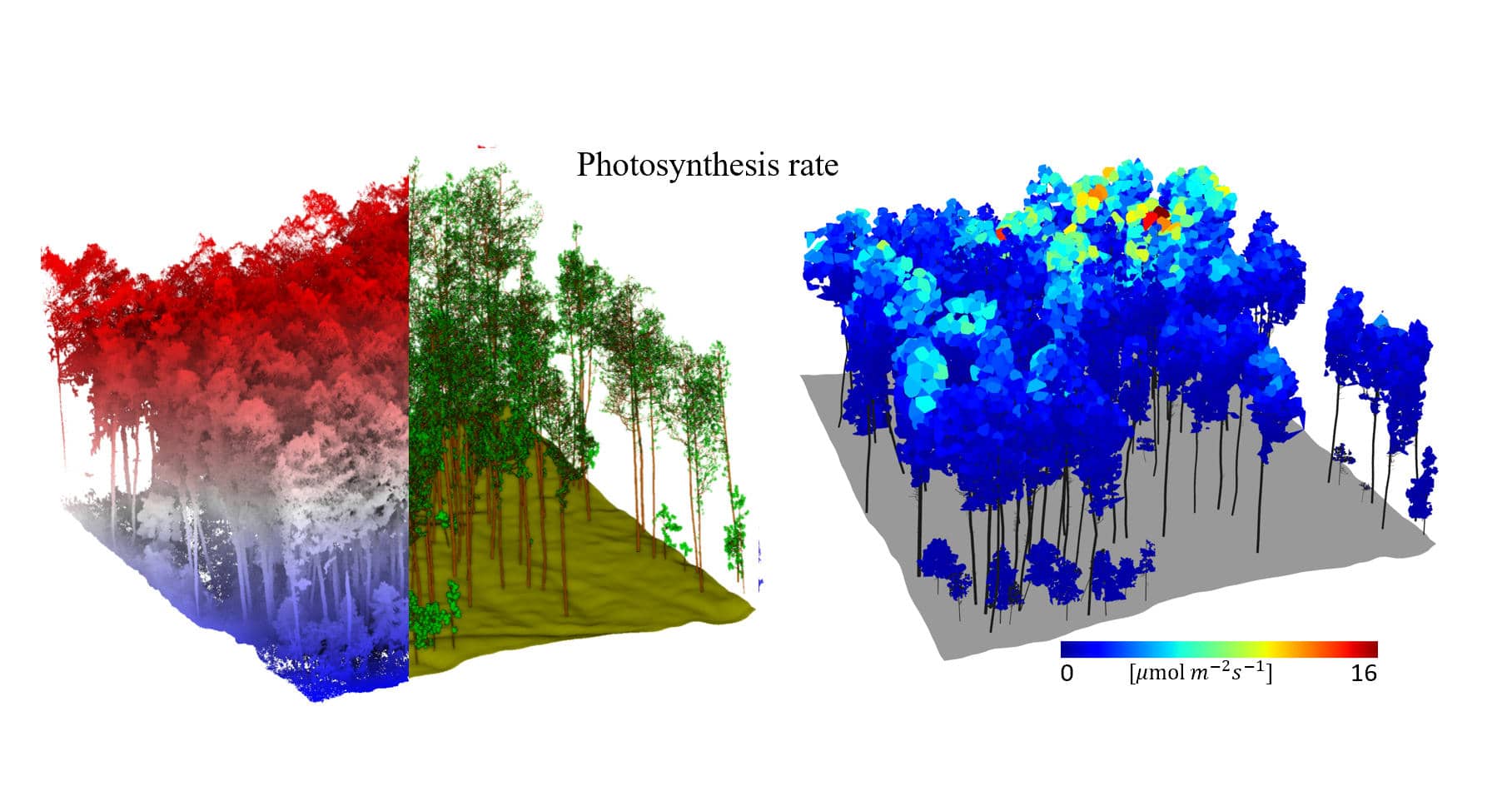
Forest Ecosystem Monitoring
Simulate the photosynthetic, chlorophyll fluorescence, and carbon cycle processes of the forest canopy.
-
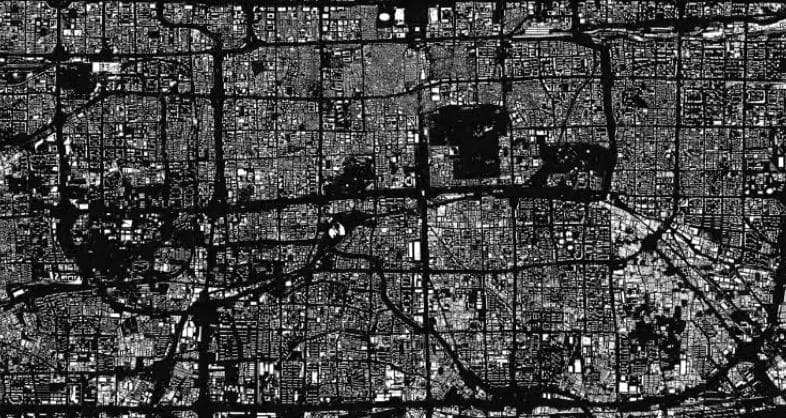
Urban Environment Monitoring
Analyze the urban heat effect and the shading impact of buildings on radiative transfer.
-
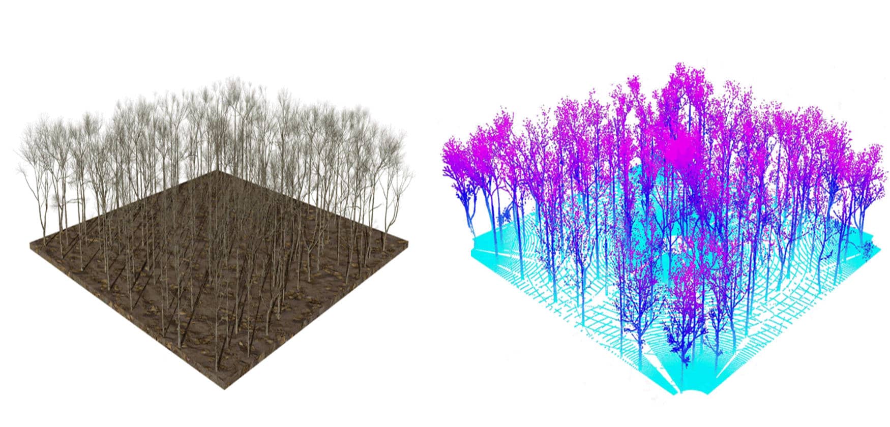
LiDAR Simulation
Generate high-precision LiDAR waveforms and point cloud data.
-
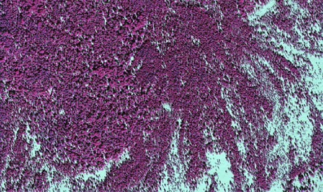
Hyperspectral Imaging
Simulate hyperspectral remote sensing data for fine spectral analysis.